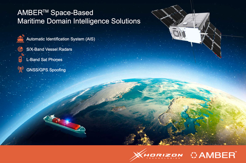
Satellite RF Intelligence
The latest technologies are on space-based satellites, these providing a huge benefit of covering much larger areas than is possible with ground surveillance sensors and include :
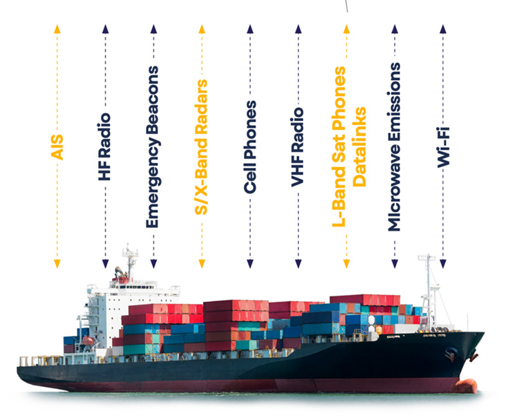
Monitoring RF emissions from vessels navigation radars, communications equipment including sat phones, AIS and VHF transmissions Optical Cameras – including multispectral and hyperspectral Synthetic Aperture Radar (SAR), these are not affected by clouds or darkness
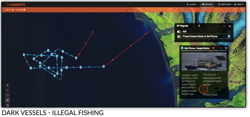
Radars on vessels transmit sequences of pulses at specific frequencies. Each radar has variations in the transmitted data and these signals can be picked up from space. Analysis and fingerprinting can be done to using the same ESM techniques as land sensors and allow us to persistently track vessels. When the fingerprint is associated with either a visual ship identification or with its AIS signal (e.g. when in port), an identification is linked to the radar signature, so the next time that vessel goes ‘dark’ it can be identified.
Satellite optical cameras and synthetic aperture radar allow visual verification of vessels to be done, for example was a vessel really where it said it was and the ability to measure the vessel size to match the vessels known dimensions.
Satellite RF data requires no infrastructure and is a Data-as-a-Service (DaaS) that is integrated with the real time maritime surveillance system to cover a much wider surveillance area and uncover non-cooperative (dark) vessels.
In the near future, these satellite-based capabilities will grow considerably, the cost will reduce, update rates of data will increase to be almost real-time and allow governments much greater powers of monitoring their entire EEZs.
RF signal detection from space Navigation X & S band radars geolocation and ESM SatPhone location AIS GPS/ AIS spoofing Large area monitoring – spots, EEZ, global Does not require tasking – always on